Digitalní archív orienťáckých map pro Jens Kastensson
|
Přihlásit
Všichni uživatelé
|
Jazyk:
Česky
Česky
Dansk
Deutsch
Eesti
English
Español
Français
Italiano
Magyar
Norsk
Polski
Português
Русский
Svenska
Türkçe
Український
|
DOMA 3.0.10
Zobrazit náhled na Google mapě
Skýt náhled na Google mapě
|
Otevřít v Google Earth
|
Zpět
<< Window + corridor (27.08.2011)
|
Family sprint training part 1 (30.08.2011) >>
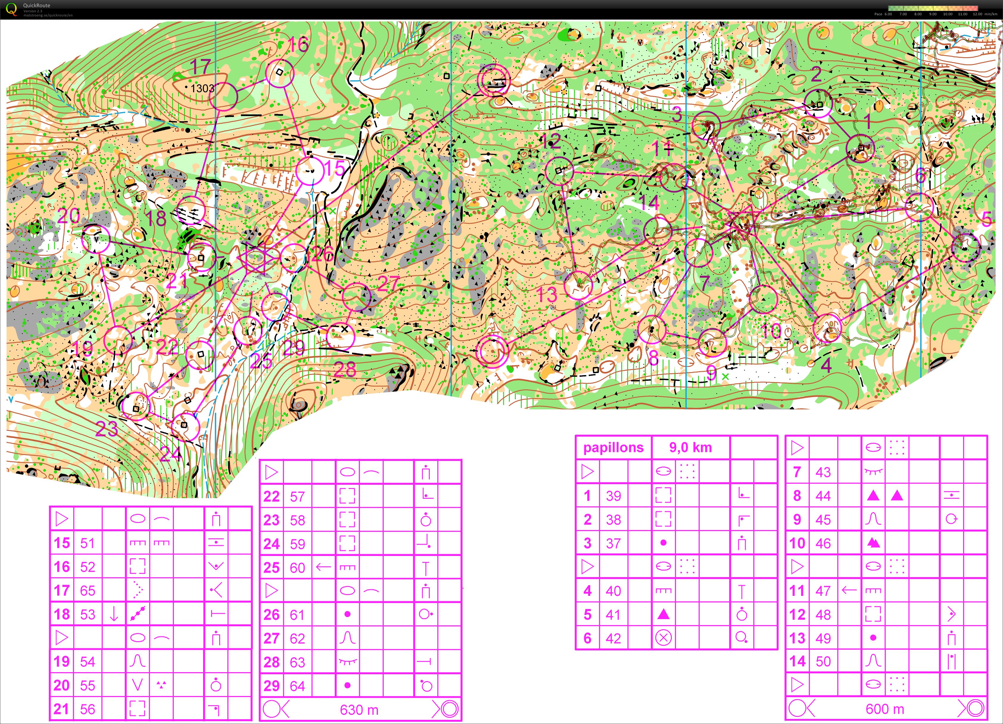
Butterfly + Downhill-O (28.08.2011)
Kategorie:
Training
Mapa/oblast:
Gréolière
Pořadatel:
Tam
Země:
FR
Skutečná délka:
9.94 km
Čas:
134:31
Distance: 8,69 km
Elevation Gain: 247 m
(The Downhill-O part is not on this map)
Zobrazit komentáře
Skrýt komentáře
(
0
)
Napiš komentář
Jméno:
Email:
Ulož
 Česky
Česky Dansk
Dansk Deutsch
 Eesti
Eesti English
 Español
 Français
 Italiano
 Magyar
 Norsk
Norsk Polski
 Português
 Русский
 Svenska
 Türkçe
 Український